Question 1829Navigation General
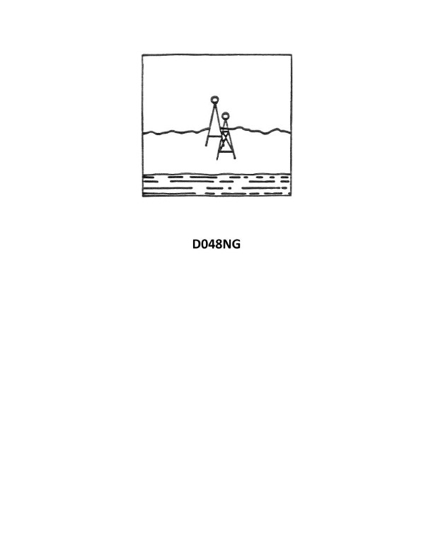
70% to passYour vessel has changed course and is heading 285°T, you are on the charted range and it appears as in illustration D048NG below. After several minutes the range appears as in illustration D047NG below and your heading is still 285°T. What does this indicate?
A
leeway caused by a NE'ly wind
B
course made good to the left of the DR track
C
south-setting current
D
north-setting current
AI Explanation
The correct answer is D) north-setting current. The key evidence here is that the vessel's heading is 285°T, but the vessel has drifted to the right of the charted range, indicating a northward set to the current. A north-setting current would push the vessel to the right of the intended track, even though the vessel's heading remains 285°T. The other options are incorrect because leeway from a northeast wind would push the vessel to the left, a course made good to the left implies a southward set, and a south-setting current would push the vessel to the left, not the right as observed.
Related Questions
Q108:When displayed under a single-span fixed bridge, red lights indicate ___________...
Q857:You are underway on course 120°T and your maximum speed is 12 knots. The eye of ...
Q497:What publication has information on the climate, distances, navigation regulatio...
Q1618:When the time is based on the movement of the visible Sun along the ecliptic the...
Q359:You are in a channel inbound from sea. A daymark used to mark a channel junction...
Ready to test your knowledge?
Take a Navigation General Practice ExamOfficial Resources
Want to practice with timed exams?
Download Coast Guard Exams for the full exam experience.
App Store