Question 41Navigation General
70% to passWhich statement concerning the chartlet in illustration D010NG below is true? (Soundings and heights are in meters)
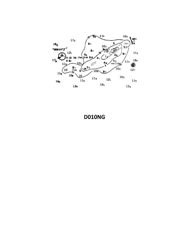
The correct answer is D) The sunken wreck southwest of Beito Island shows the hull or superstructure above the sounding datum. This is correct because the chartlet indicates a sunken wreck symbol southwest of Beito Island, which implies that a portion of the wreck is visible above the sounding datum (the reference water level used for the depth soundings shown on the chart). The other options are incorrect because: A) the chartlet does not provide information about the Maury Lightship's swing circle diameter, B) there is no 12-meter deep hole indicated near Beito Island, and C) the position of the lightship is indicated by the center of the star symbol, not the mast.
Ready to test your knowledge?
Take a Navigation General Practice ExamWant to practice with timed exams?
Download Coast Guard Exams for the full exam experience.
App Store